Colter Babbitt Ranch
Location: U.S. Highway 60 to Forest Service Road 3123 to Forest Service
Road 1326 to 2 Track Road; or Highway 260 from Eagar to Forest Service Road 3125 to 2 Track Road to Subject Property.
Land Tenure:
|
480 |
Acres Deeded Land |
|
1,640 |
Acres State Grazing Lease No. 05-2039 |
|
2,120 |
Acres Total or 3.3 Sections |
REAL ESTATE TAXES: The Deeded Property is Apache County Assessor’s Parcel #103-18-003 and 103-18-006B. The 2023 real estate taxes were $36.76.
WATER: Shuster Spring in Section 22 T9N R27E and the Little Colorado River in Section 16 T8N R28E.
IMPROVEMENTS: There is a Perimeter Fence on 1,480 acres in Section 15, 22 and 27 where Shuster Spring is located.
ELEVATION: The elevation of the property is 7,740’ feet above sea level.
CLIMATE: Cold winters and mild summers
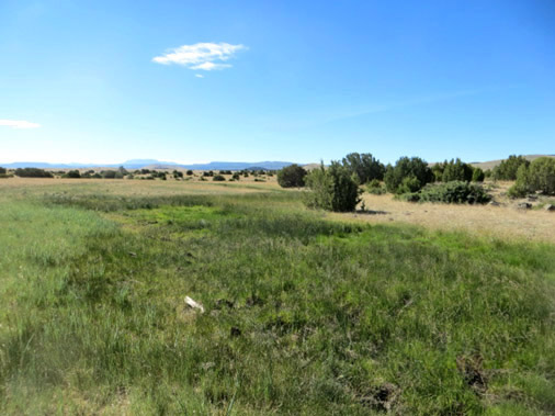
VEGETATION: Blue Grass, Tobosa and scattered Pinyon-Juniper Trees
TOPOGRAPHY: Rolling Hills and Open Grassland
PRICE: $1,400,000
TERMS: Cash
REMARKS: The property is currently leased to the neighbor for cattle grazing. State Land Section 16 T8N R28E is not connected to State and Deeded pasture at Shuster Spring.
Photos of this Ranch Maps of the Ranch
Hebbard & Webb, Inc.
2929 N. 44th Street, Suite #208
Phoenix, AZ 85018-7238
(602) 275-5715 Office
(800) 615-5715 Toll-Free
(602) 244-1340 Fax
Email: HWIncRE@aol.com